 |
 | |
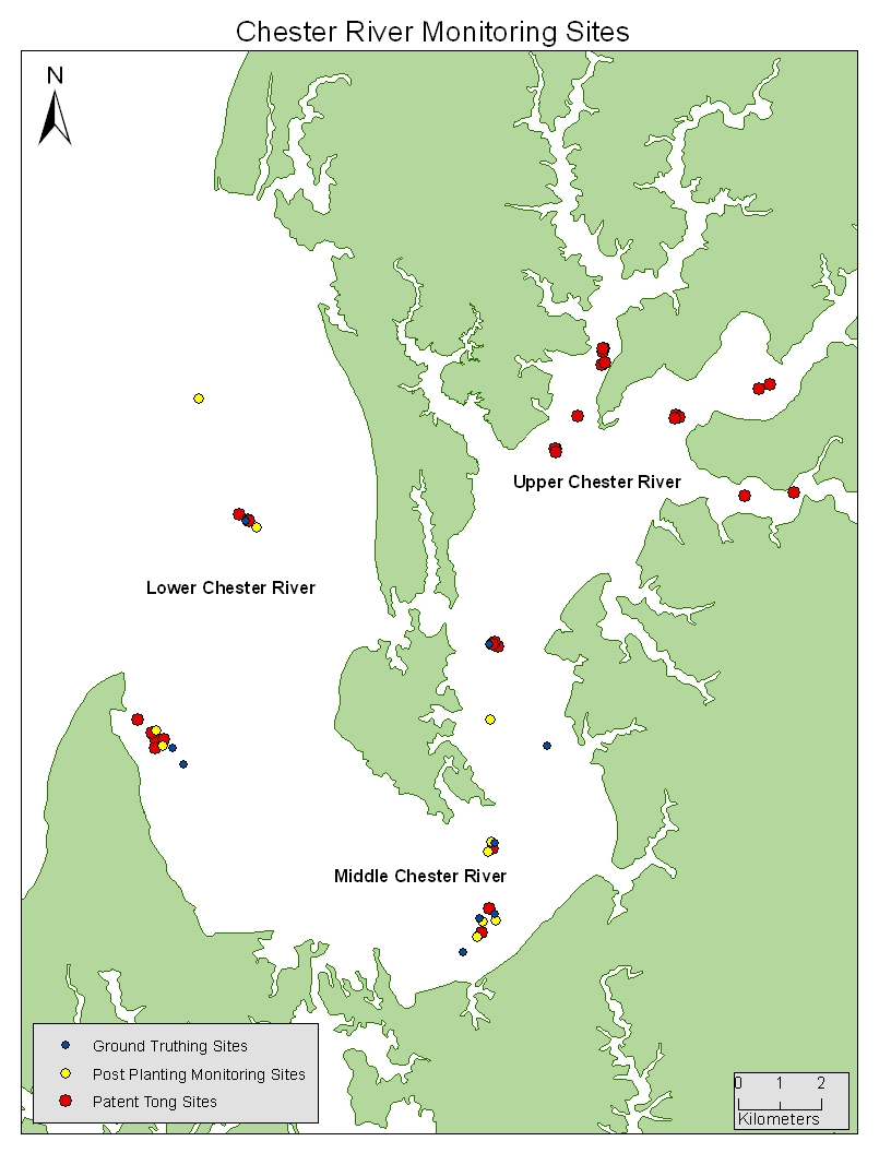
Monitoring Oyster Restoration: Chester River
Refer to the map below to identify sites throughout the Chester River where we have conducted monitoring surveys since 2008. Monitoring includes ground truthing, post-planting monitoring, and patent tong surveys. To see a more detailed map of each section of the river, click on the region name in the map.
If you have questions about specific data collected at each/any site, please contact us at: paynteroysterlab@gmail.com.
|
||