 |
 | |
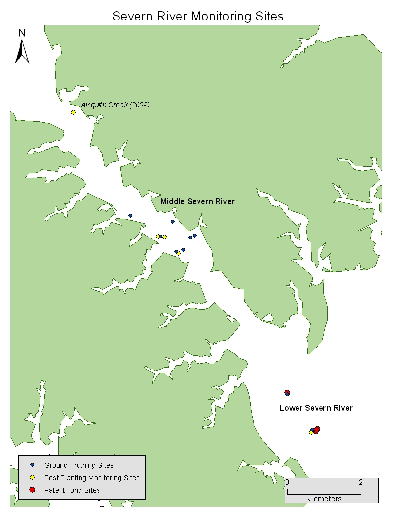
Monitoring Oyster Restoration: Severn River
Refer to the map below to identify regions within the Severn River where we have conducted monitoring surveys since 2008. Monitoring includes ground truthing, post-planting monitoring, and patent tong surveys. To see a more detailed map of each region, select the region name within the map. Site names shown on the below map in italics represent sites where only a single survey was conducted, and are not included in regional maps. Years in parentheses indicate the year in which each survey took place.
If you have questions about specific data collected at each/any site, please contact us at: paynteroysterlab@gmail.com.
|
||